Miami Picture Map - Illustrated map of a boat show in Miami Beach, Florida
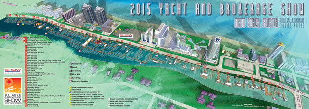
Miami Picture Map - I have just completed the illustrated map for the 2015 Yacht and Brokerage Show in Miami Beach. I am honored to say that this is my fifth year creating the map. This year I opted for a more painterly look, but kept last years angle of view. Below you can see previous years maps for comparison.
I also created new "You are here" sign maps (see last year's) and revised the transit map that is seen on signage around the show and in the program.
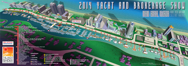
2014 Yacht and Brokerage Show in Miami Beach map
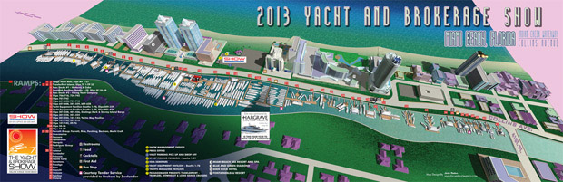
2013 Yacht and Brokerage Show in Miami Beach map
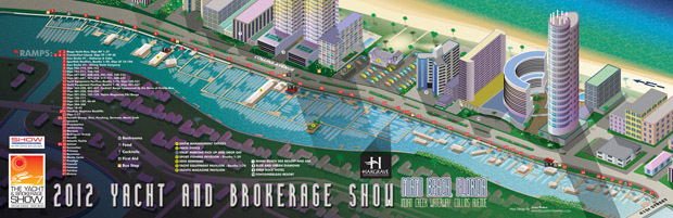
2012 Yacht and Brokerage Show in Miami Beach map
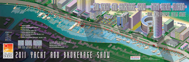
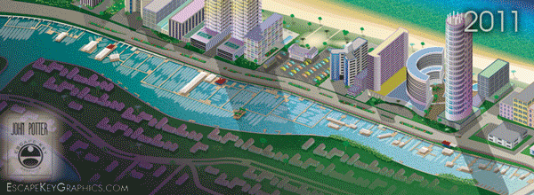
2011 Yacht and Brokerage Show in Miami Beach map
Escape Key Graphics’ vector based maps can be blown up to a poster of any size with little or no degradation and Escape Key Graphics’ 3D maps can be rendered from different angles and zoom extents creating endless new possibilities. The 3D method can also provide a more realistic look than the vector method. In both cases buildings, paths and everything else in your map is like an object that can be moved, shrunk, deleted, etc, making revisions easy and quick. Expansion of your park, site, or facilities seldom means recreating your map from scratch.
Escape Key Graphics can create great maps for boat shows, towns and cities, campuses, hospitals, housing complexes or just about any other place. Escape Key Graphics can show how work flows through your factory, how an ecosystem works or produce any of a number of other map like visual solutions.
Other projects and clients include:
I am planning on attending this year's show and love the ease of direction your map provides. I like the coordinated artwork through out the show as it's easy to identify as you move about-glad to see you are doing this project again this year.