Illustrated Map for a Magazine - Boat Show Map as Magazine Illustration
Illustrated Map for a Magazine - Be sure and check out the illustrated map foldout I created in the the November issue of ShowBoats International Magazine available in bookstores and on news stands now.
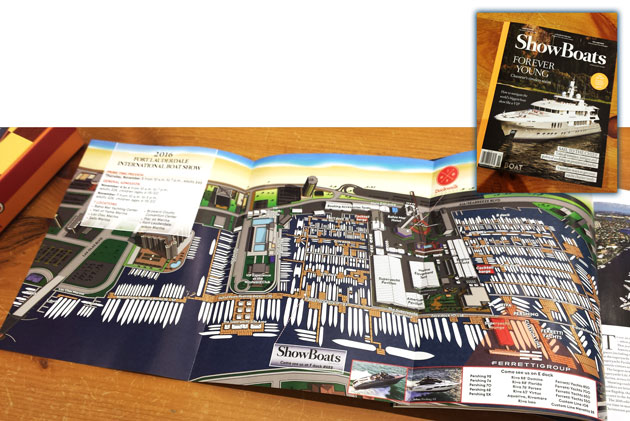
Escape Key Graphics’ vector based maps can be blown up to a poster of any size with little or no degradation and Escape Key Graphics’ 3D maps can be rendered from different angles and zoom extents creating endless new possibilities. The 3D method can also provide a more realistic look than the vector method. In both cases buildings, paths and everything else in your map is like an object that can be moved, shrunk, deleted, etc, making revisions easy and quick. Expansion of your park, site, or facilities seldom means recreating your map from scratch.
Escape Key Graphics can create great maps for boat shows, towns and cities, campuses, hospitals, housing complexes or just about any other place. Escape Key Graphics can show how work flows through your factory, how an ecosystem works or produce any of a number of other map like visual solutions.
Other projects and clients include:
Mr. Potter-
i always like your layout pages as it is so helpful in knowing where you want to go-saves time and a lot of walking. It is easy to read and I like the graphics.