Map showing the distance to points of interest from a residential high-rise - Area Highlights Map
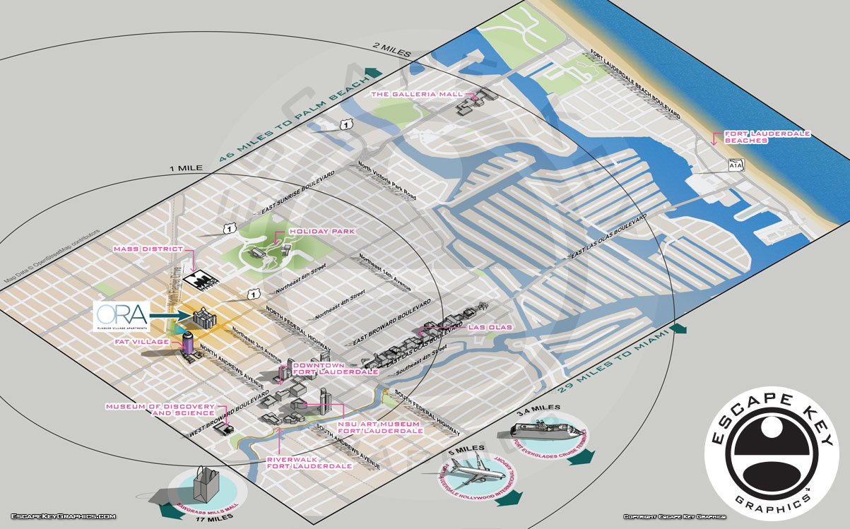
This project was to show the geographical advantages of living in a residence tower in Fort Lauderdale's Flagler Village neighborhood. The client requested I make a relatively conventional street map with some 3D points of interest. The points of interest were to be labeled so that potential residents could see at a glance what a convenient location the condos are.
This was the first time I have used OpenStreetMap, but it was a great open resource for geographical data. That flat street map data was combined with some minimalist models made in Sketchup and a stock model or two as well. I added distances to neighboring cities and radius circles for a distance reference.
The property is in an artsy part of town near both the MASS District and FAT Village which are local arts districts. The architecture of the building and their promotional website have a classy, minimalist, high tech feel with a limited color palette that suits the area well. For consistency I carried that look over into the map.
If you found this by mistake and are instead interested in the property on my map please visit THIS SITE.