
Newport International Boat Show: A Premier Marine Event & Showcase for Custom Map Design

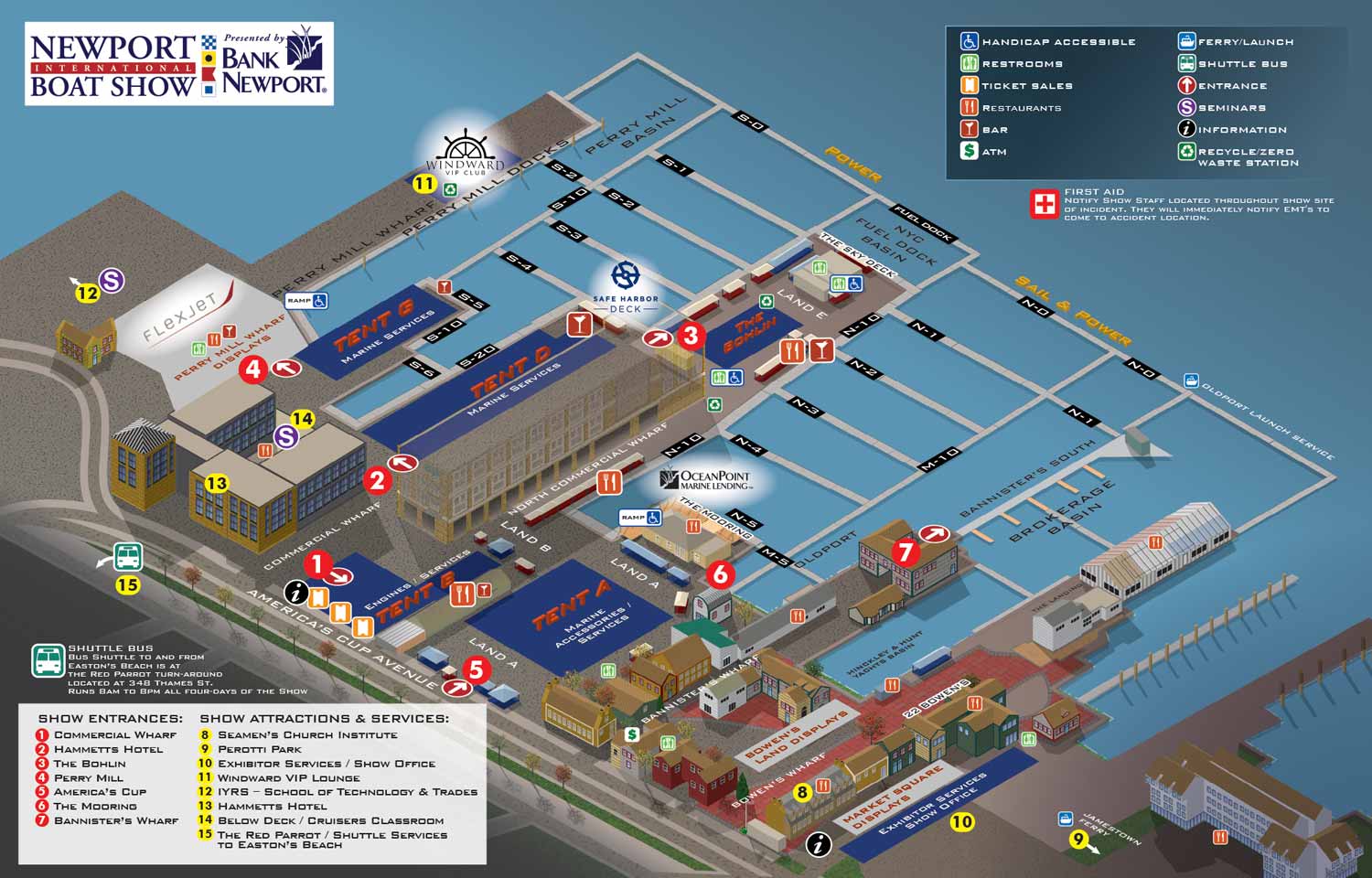
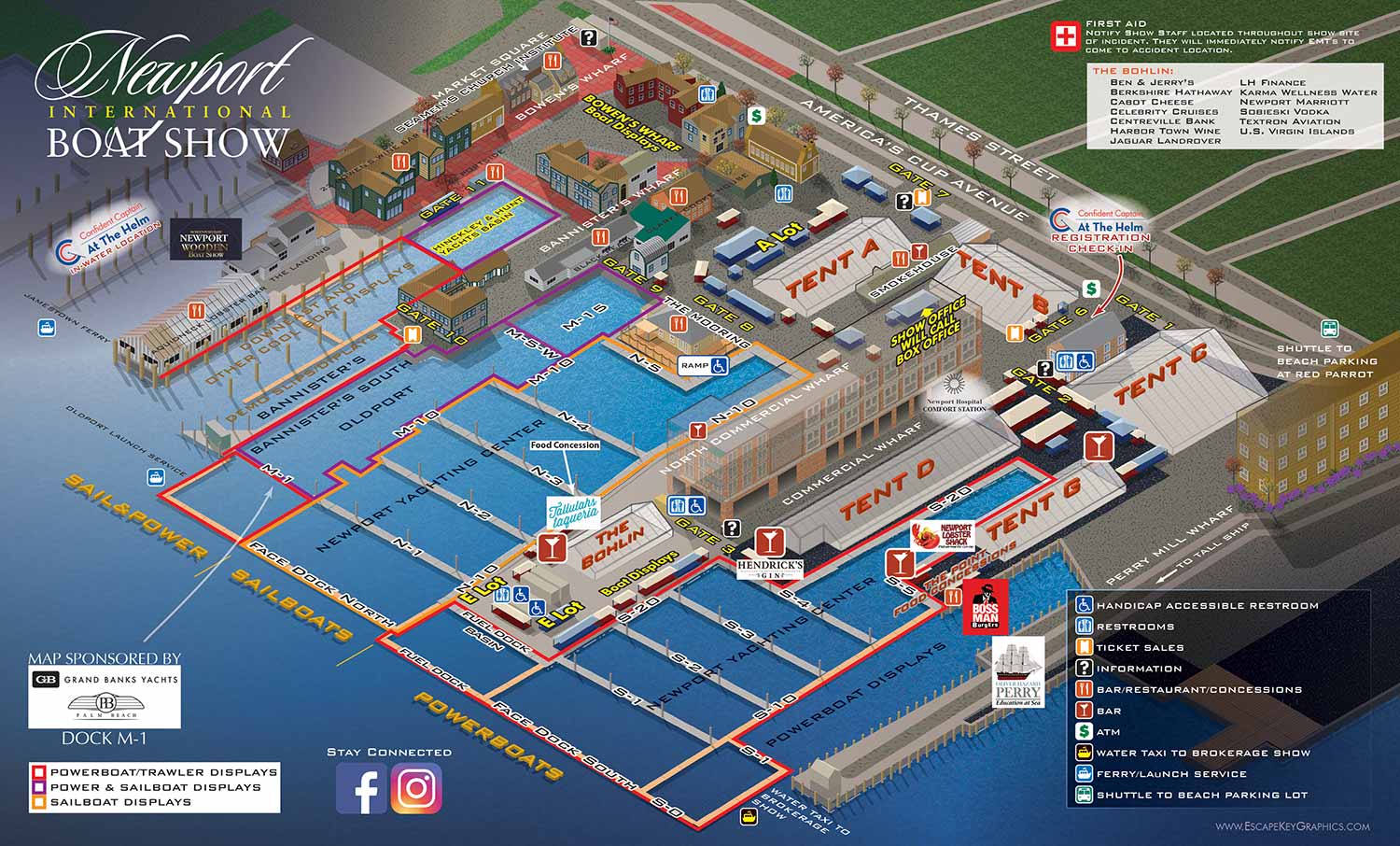
I have been illustrating and designing the official map for the Newport International Boat Show since 2012. Over that time the show has evolved through several ownership and management changes and is now operated by Informa Markets. The event is set along Newport, Rhode Island’s historic waterfront, and the map reflects that setting with a restrained, earthy color palette that supports a classic New England look and feel. As the show has grown, the mapped area has gradually expanded south and new waterfront buildings and features have been added.
The map itself has gone through several major design phases. Early versions were vector based isometric illustrations oriented from Newport Harbor. Later the orientation shifted to a more inland viewpoint to improve clarity and wayfinding. In 2025 the map was fully rebuilt using SketchUp, allowing for a more consistent visual language that aligns with other major boat shows managed by Informa while still retaining the character of the Newport waterfront.
Navigation has always been a primary focus. Docks use a clear letter and number system, while frequently repeated facilities and amenities such as restrooms and services are shown with icons so they only need to be identified once. As of 2025 the map key entrances as numbered red markers, attractions and services as numbered yellow markers, and exhibit tents as orange pill shaped labels marked with the word tent and a corresponding letter. This layered system helps visitors find general areas quickly and then narrow down specific destinations.
In addition to the main show map, I regularly create a series of detailed tent maps that show individual exhibitor locations within each tent. These are now simple overhead diagrams produced as vector artwork in Adobe Illustrator and are designed to be clear, direct, and easy to update as exhibitor layouts change.
As a small point of local interest, the Newport International Boat Show map sits directly across Newport Harbor from another long term client of mine, Conanicut Marina in Jamestown. Also, please don't confuse the Newport International Boat Show with the Newport Beach International Boat Show for which I also make a map.
Maps For Newport International Boat Show:
- About Newport International Boat Show
- Main Map: 2026 | 2025 | 2024 | 2023 | 2022 | 2021 | 2019 | 2018 | 2017 | 2016 | 2015 | 2014 | 2013 | 2012
- Tent Details Map: 2026 | 2017 | 2016 | 2015 | 2014 | 2013 | 2012
- Video: 2012


BOAT SHOW MAPS ARTICLE - SOUTHERN BOATING MAGAZINE 2016:
"Navigating Miami’s multiple venues is easier when you use a map. If you’re at Yachts Miami Beach – formerly The Miami Yacht and Brokerage Show – the man behind those maps is John Potter of Escape Key Graphics, who created his first boat show map for the 201 Fort Lauderdale Int’l. Boat Show. It wasn't long before the creative concept spread. Less intimidating than site plans and more easier to follow than an aerial photography, Potter’s maps now grace the Stuart Boat Show, St. Petersburg Power & Sailboat Show in Florida and International Boat Shows like Newport, Palm Beach and Panama. His work on these shows frequently extends to many maps such as detailed area maps and transit maps. Potter’s maps can also be seen beyond the yachting industry in theme parks, resorts, wildlife sanctuaries, municipalities, campuses and gardens including Flamingo Gardens, Dinosaur World parks or The Dover International Speedway."
ADDENDUM:
I am presently responsible for illustrated maps for The Chicago International Boat Show, The Fort Lauderdale International Boat Show, The Miami International Boat Show, The Newport International Boat Show, The Newport Beach International Boat Show, The San Diego International Boat Show, The Windy City Boat & Yacht Show, The Palm Beach International Boat Show, The Suncoast Boat Show and the The Saint Petersburg Power and Sailboat Show.
There is a directory in my Boat Show Map Portfolio
PORTFOLIO GALLERIES
- Illustration work: Start with custom illustration and cover design, then view illustrated maps and architectural renderings.
- Fine art: Discover original paintings and drawings, the Custom Halftone Series, and mural projects.
- Design & motion: Check out the graphic design gallery, then move on to motion graphics and animated illustration.
- Maps by sector: I produce illustrated maps for boat shows, resorts, marinas, real estate, transit & parking, towns & cities, parks, and wayfinding systems.
- More creative services: Additional offerings include cover illustration, vehicle wraps, proposal renderings, and street art.
- Artistic methods: My work spans vector art, isometric & axonometric views, traditional painting, black & white illustration, GeoData mapping, overhead perspectives, and halftone effects. Recently I have also begun to utilize AI in some cases.
- Preferred software: I rely on Photoshop, Illustrator, SketchUp Pro, and InDesign, plus Premiere Pro & After Effects for motion projects.