Bedwell Residential Park Map
Client: Tingdene Residential Parks
For information on Bedwell Residential Park please visit Tingdene-Parks.net
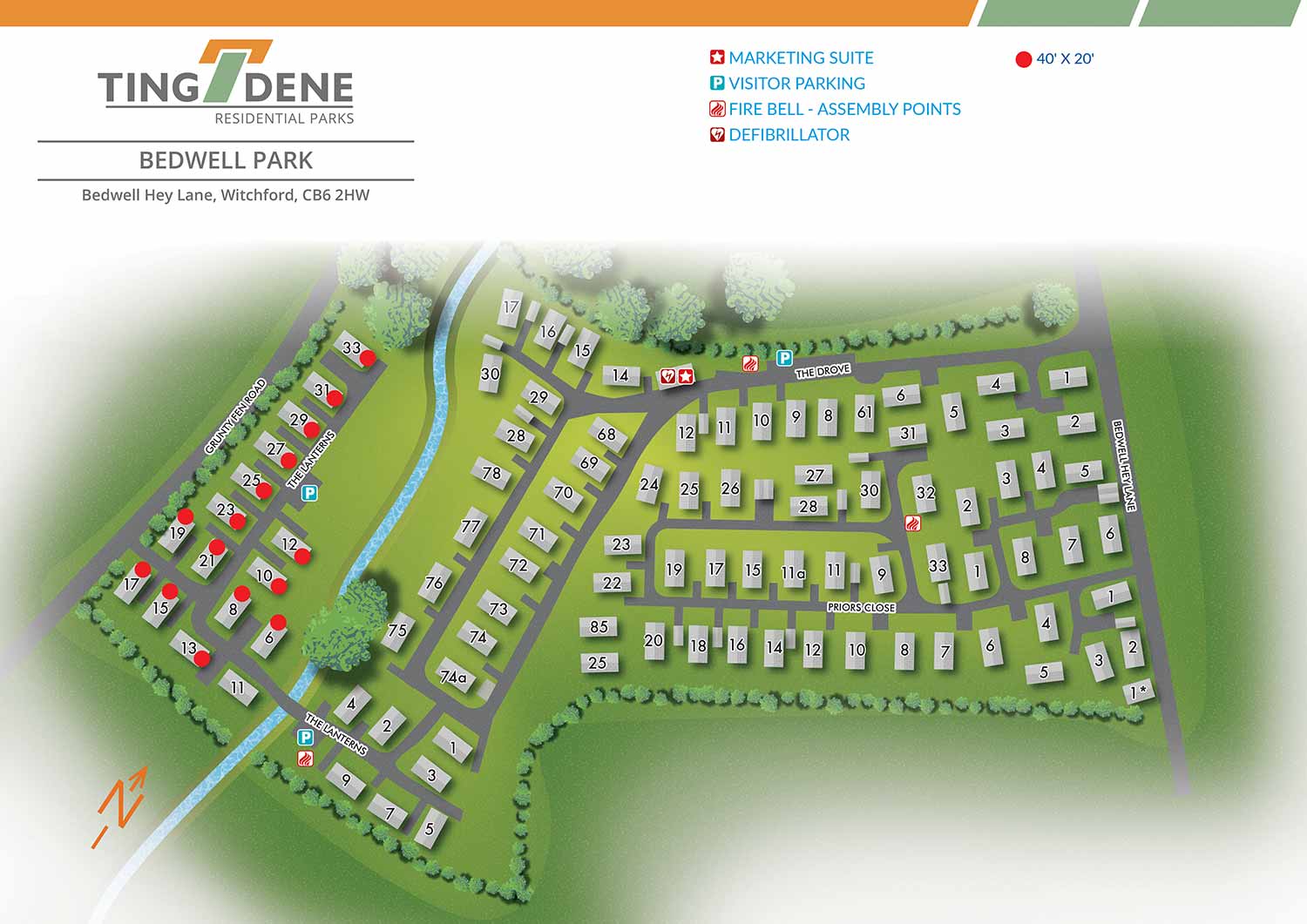
Bedwell Park is located on the edge of the Cambridgeshire village of Witchford, approximately three miles from the historic cathedral city of Ely. This setting offers residents the tranquillity of village life while remaining close to Ely’s shops, services, and cultural attractions. The surrounding landscape and convenient location make Bedwell Park an appealing option for those seeking a well connected yet peaceful residential environment.
Escape Key Graphics created this illustrated overhead real estate map to clearly present the layout of the park and support ease of navigation. Park amenities, including parking areas and the marketing suite, are identified using simple and consistent graphic icons. Repeating features are shown in a uniform way, helping the map remain clear and easy to read at a glance for residents, visitors, and prospective buyers.
Designed to support both practical and promotional needs, the map functions effectively as on site signage and general wayfinding. At the same time, it serves as a polished marketing asset, presenting the layout and features of Bedwell Park in a professional and approachable manner. This clear visual communication helps convey the character, setting, and overall appeal of the residential park to those considering it as a place to live.


WORK FOR TINGDENE - COMBINED MARINA AND RESIDENTIAL PARK MAPS:


PORTFOLIOS
- Illustration Portfolio: Start here for custom illustration and book covers. You can also browse illustrated maps and architectural rendering.
- Fine Art: I offer original paintings and drawings, including my Custom Halftone Series. You will also find mural work here.
- Graphic Design & Motion: View my graphic design portfolio. After that, explore motion design and animated illustrations.
- Maps by application: I create illustrated maps for boat shows, resorts, marinas, real estate, transportation, transit and parking, towns and cities, parks, and wayfinding.
- Additional project types: I also produce cover illustration, vehicle and vinyl wraps, proposal renderings, and street art.
- Illustration methods: My techniques include vector, isometric and axonometric, painting, black and white, GeoData maps, overhead maps, and custom halftones.
- Software portfolios: I work primarily in Adobe Photoshop, Adobe Illustrator, SketchUp Pro, and Adobe InDesign. For motion projects, I use Premiere Pro and After Effects.