Bellmere Winds Golf Resort Illustrated Cottages Map
Client: Great Blue Resorts
I am the artist who made these maps. They are many years old. For the latest and most accurate information on any of these resorts please visit BreatBlueResorts.com
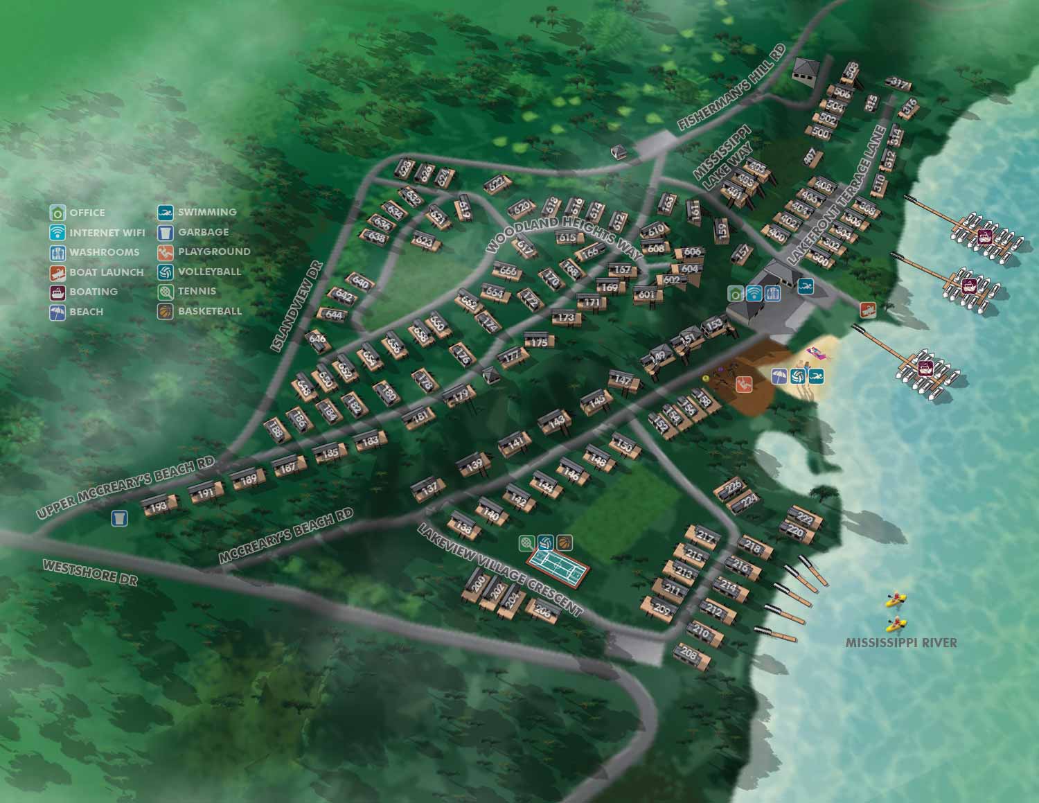
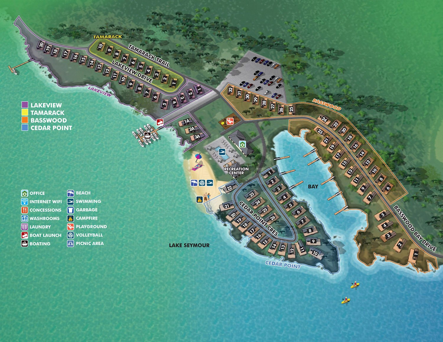
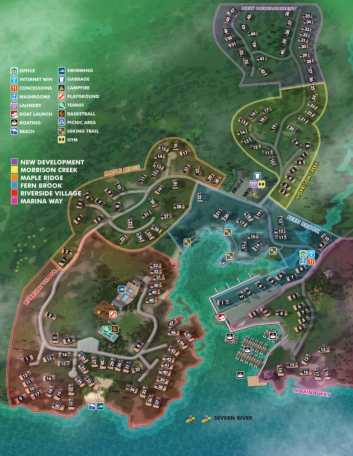
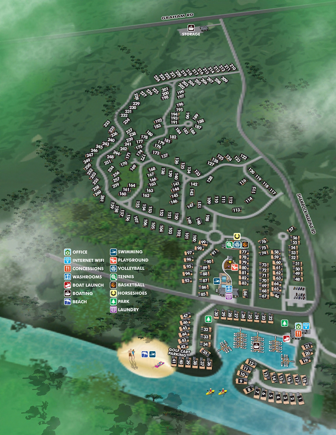
Great Blue Resorts was one of my primary clients for a number of years. I created illustrated maps for many of the properties they owned or represented across Ontario. The map shown here is for Bellmere Winds Golf Resort.
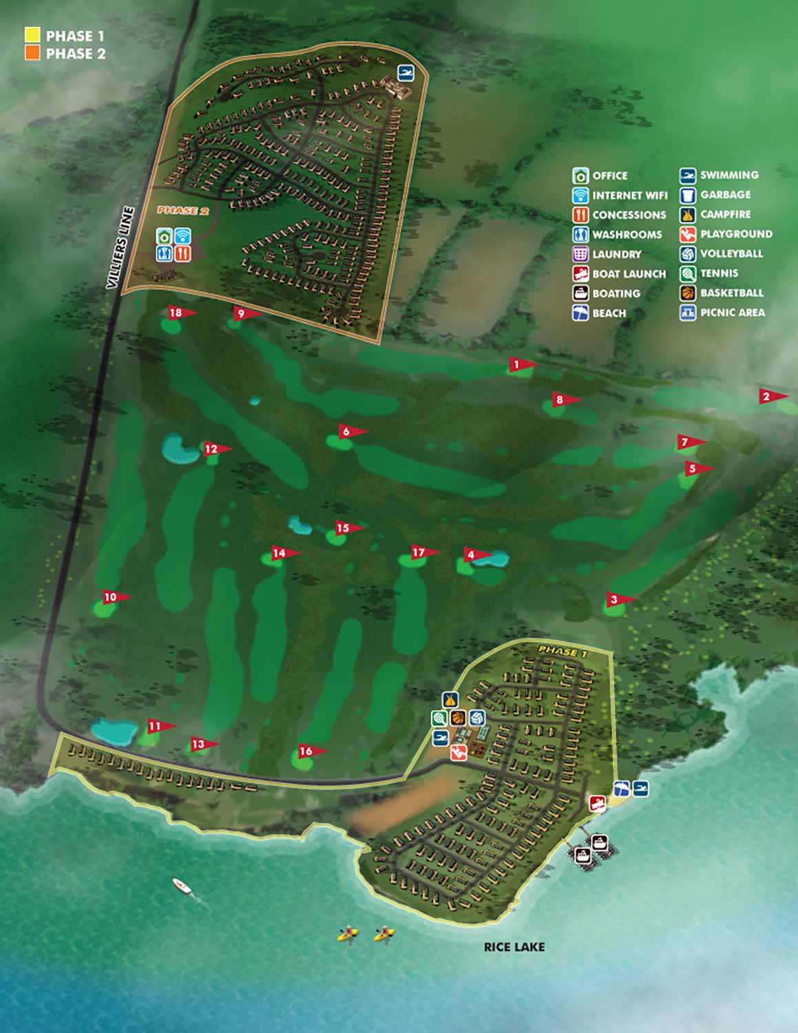
Bellmere Winds Golf Resort is open to all ages and levels to enjoy, with breathtaking views of Rice Lake, located in The Kawarthas. Not only does the resort offer a beautiful course to our golfers, but it offers the opportunity of resort cottage ownership and stay & play vacation packages.
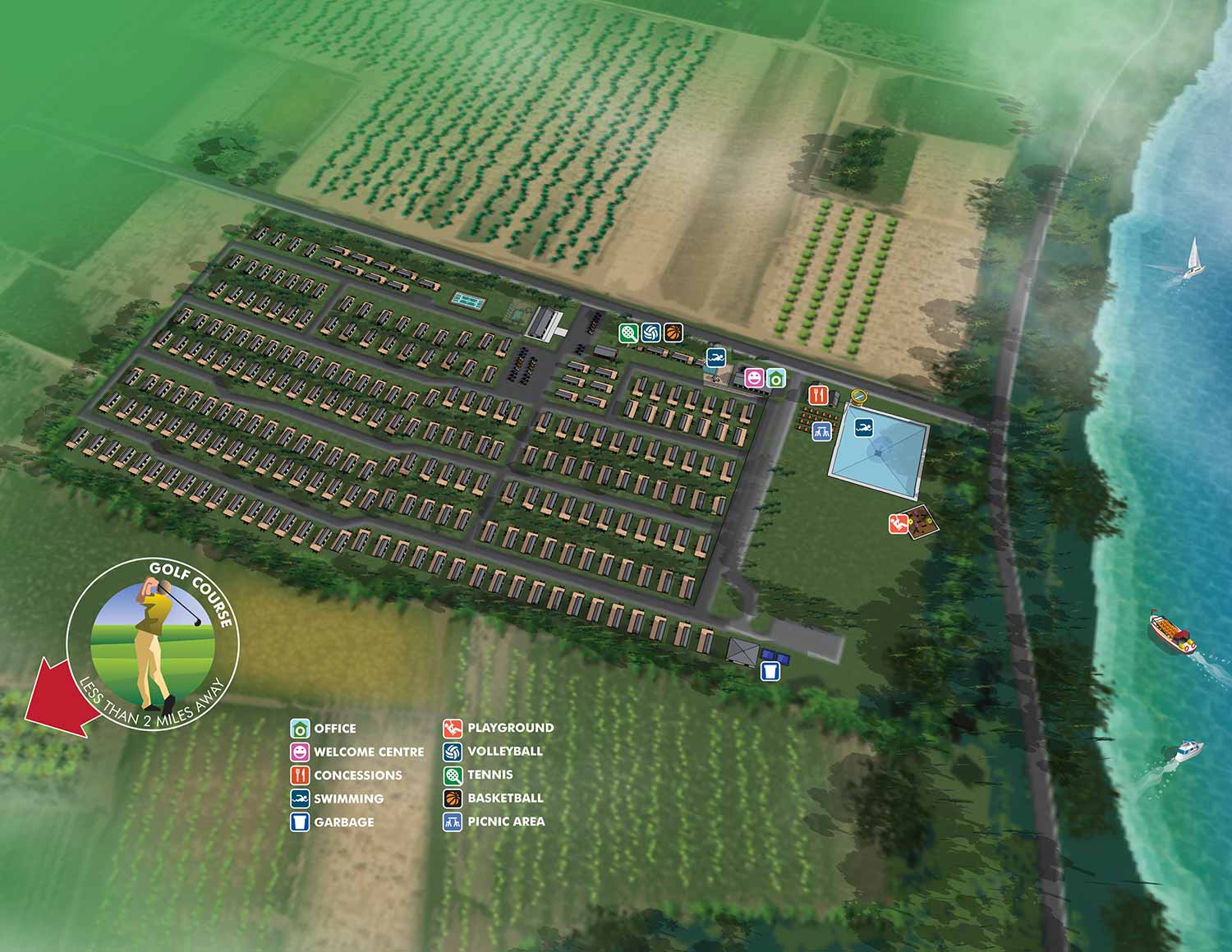
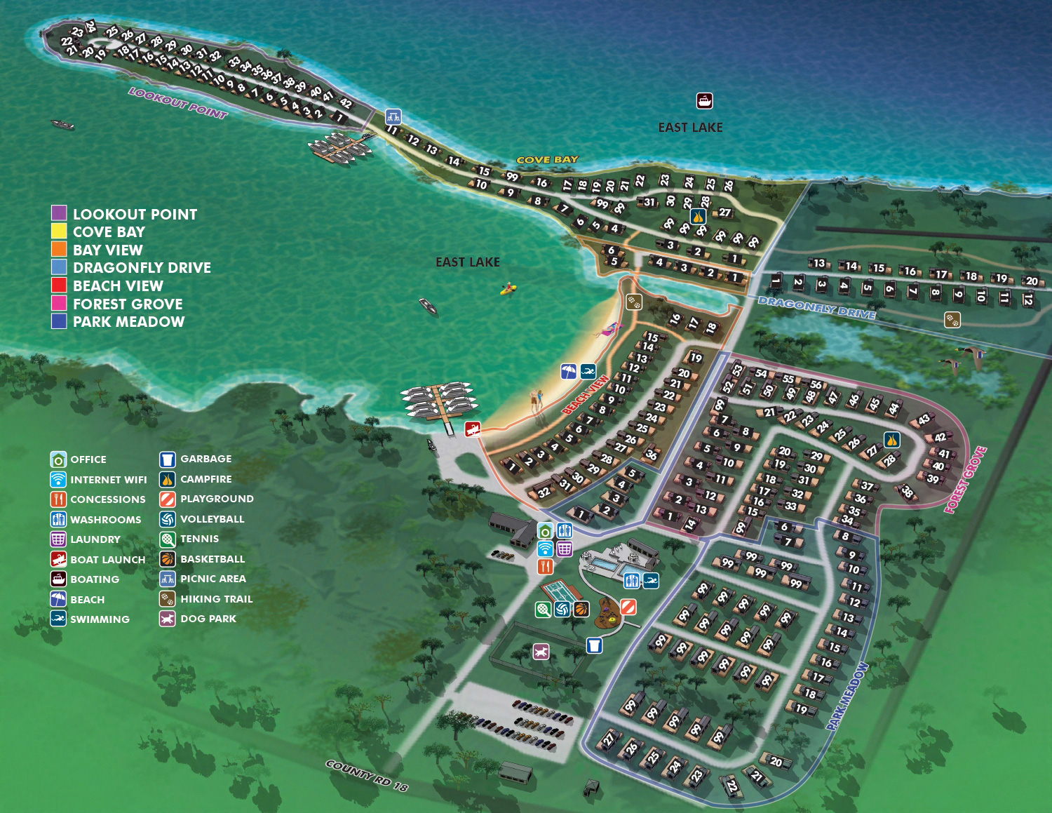
My approach for these projects was consistent. Provide a clear overview of the property and use graphical icons to mark facilities guests actually need. Lodging, dining, recreation, parking. Everything in one place, easy to find at a glance.
This particular map also shows development phases across the property. The golf course is mapped comprehensively, including all eighteen holes. Guests can plan their round before they ever step onto the first tee.
If you manage a resort, a golf course, or a mixed use property and need a clear, useful illustrated map, contact me. I have done this work before and I can do it for you.
GOLF RELATED ILLUSTRATED MAPS:


ABOUT RESORT MAPS:
Clear wayfinding is essential to a positive guest experience, and a well designed resort map plays a major role in making that possible. When guests can easily locate amenities, lodging, dining, and recreation without confusion, they enjoy their stay more and place fewer demands on staff for directions. A custom illustrated resort map provides an immediate visual overview of the property, helping guests orient themselves quickly while reinforcing the resort’s brand and atmosphere.
I have created custom resort maps for a wide range of destinations, from waterfront properties and resort marinas to locations well inland. These projects include rustic cabin resorts set in wooded environments, luxury spa destinations adjacent to golf courses, and mixed use resort properties with complex layouts. In addition to full property maps, I have also produced detailed illustrated floor plans showing the interior layouts of rental apartments and resort accommodations, allowing guests to understand spaces before they arrive.
Clients consistently report that these illustrated maps become one of the most useful tools they provide to guests. They reduce confusion, minimize the need for staff to give repeated directions, and help visitors feel confident navigating the property on their own. Whether used in print, signage, mobile apps, or websites, custom resort illustrated maps offer both practical value and visual appeal, making them an effective investment for resorts focused on guest satisfaction and operational efficiency.
PORTFOLIOS
- Illustration Portfolio: Start here for custom illustration and book covers. You can also browse illustrated maps and architectural rendering.
- Fine Art: I offer original paintings and drawings, including my Custom Halftone Series. You will also find mural work here.
- Graphic Design & Motion: View my graphic design portfolio. After that, explore motion design and animated illustrations.
- Maps by application: I create illustrated maps for boat shows, resorts, marinas, real estate, transportation, transit and parking, towns and cities, parks, and wayfinding.
- Additional project types: I also produce cover illustration, vehicle and vinyl wraps, proposal renderings, and street art.
- Illustration methods: My techniques include vector, isometric and axonometric, painting, black and white, GeoData maps, overhead maps, and custom halftones.
- Software portfolios: I work primarily in Adobe Photoshop, Adobe Illustrator, SketchUp Pro, and Adobe InDesign. For motion projects, I use Premiere Pro and After Effects.