
Maps of Campuses Portfolio

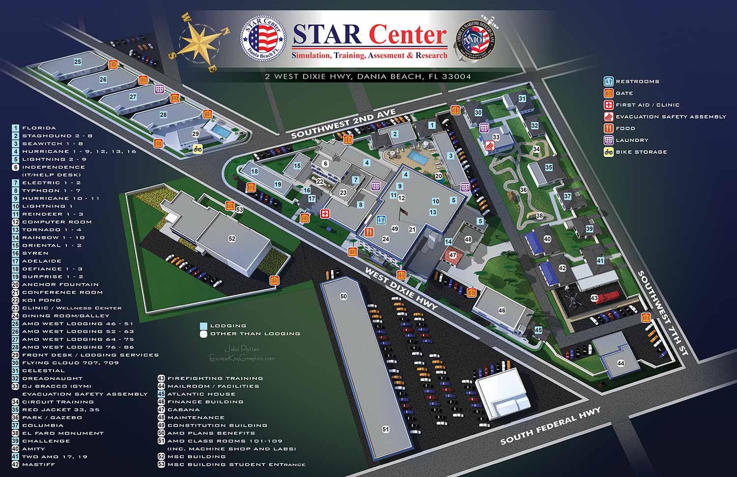

Maps Built for Schools and Universities
I create illustrated campus maps for K–12 schools, colleges, universities, trade and other schools. Each project receives the same attention I bring to large commercial and municipal mapping work. Time is spent up front understanding the character of the campus and what the map actually needs to accomplish. Navigation is often the primary goal, but communication and visual storytelling matter too. The finished map reflects both the physical layout and the distinct identity of the institution.
Techniques Matched to the Task
No single illustration method works for every campus. Some projects call for isometric or axonometric views that show buildings in three dimensions. Others benefit from architecturally inspired perspectives built from SketchUp models. Traditional overhead maps informed by geographic data are also part of my regular approach. This flexibility allows me to match the visual style directly to the audience while maintaining accuracy, clarity, and strong design.
Where These Maps Are Used
Students, staff, and visitors rely on these maps every day for basic wayfinding. Beyond navigation, institutions use them for marketing materials, campus planning, and facilities management. Signage systems, websites, mobile apps, printed brochures, and event guides all benefit from a consistent, well crafted visual reference. One map often serves many purposes across many years.
Built for Updates, Not Replacement
Campus maps change. New buildings go up. Pathways are rerouted. Temporary events need to be marked. I deliver final files with the illustrated artwork as a fixed image while labels, keys, and graphic elements remain on fully editable layers. This setup allows clients to make simple in house updates without touching the original illustration. A new portable classroom or a relocated bus stop does not require a full redesign.
Ready to Map Your Campus
If your school or university needs a clear, engaging, and durable campus map, I am ready to begin that conversation. Contact me through Escape Key Graphics to discuss your project and request a quote.


I am currently accepting new commissions for . Tell me about your resort, marina, or event and I will let you know how I can help. Contact me.
BROWSE MY WORK
- Illustration: Browse custom illustrations, book cover art, illustrated maps, and architectural renderings.
- Fine art: View original paintings and drawings, the Custom Halftone Series, and mural commissions.
- Graphic design & motion: See design projects, then watch motion reels and animated pieces.
- Maps by use case: Explore illustrated maps created for boat shows, resorts, marinas, real estate, transportation & parking, cities & towns, parks, and wayfinding.
- Specialty projects: Also check out cover design, vinyl & vehicle wraps, proposal renderings, and street art.
- Style & technique: Discover vector, isometric, painterly, monochrome, data-driven, bird's-eye, and halftone approaches.
- Tools I use: Everyday software includes Photoshop, Illustrator, SketchUp, and InDesign; motion work relies on Premiere & After Effects. Recently I have begun some work using AI as well.