
Illustrated Map for the Suncoast Boat Show in Sarasota, Florida
Client: Informa Markets
I am the illustrator and designer of this map. If that is what you are interested in please proceed to explore my site.
If you want the latest and most accurate information about attending the Suncoast Boat Show please visit their official site at SuncoastBoatShow.com
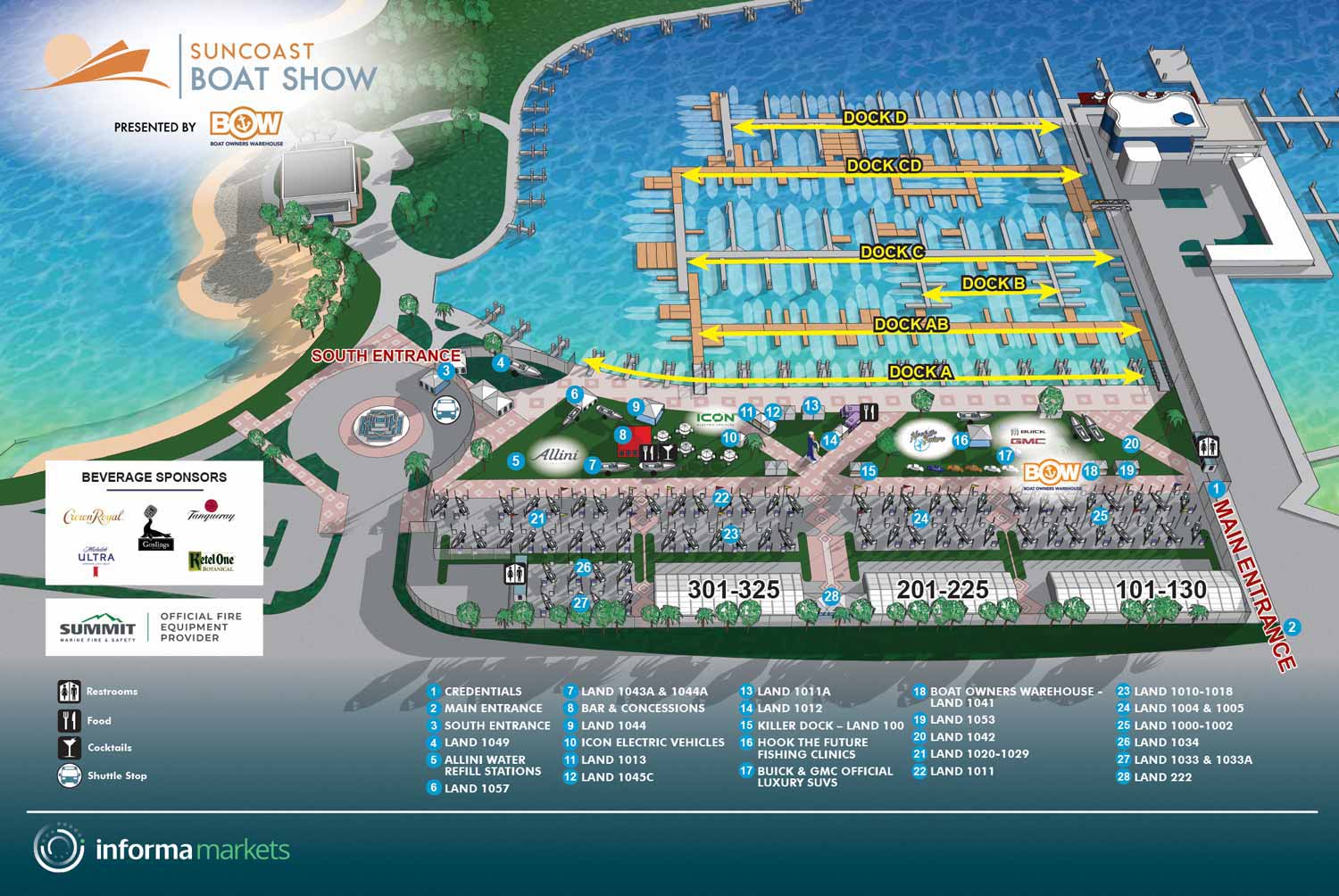
The 2024 Suncoast Boat Show map continues the established and effective visual system developed for this event. This year's updates were routine, focusing on integrating the latest layout information. The usual revisions to the floating dock configurations and land based display areas were implemented based on the current plans supplied by the client. Corresponding text within the map key was also updated to reflect these changes.
The illustration is generated from the same reliable three dimensional digital model that has served as the geographic foundation for this show for several years. The proven graphic framework, including the keying system and the treatment of sponsor logos, remained consistent. This stability is a positive indicator, demonstrating that the core design is functionally sound and that returning visitors benefit from a familiar and intuitive navigational aid.
A map requiring only these standard annual updates highlights the value of a well built initial asset and a streamlined professional process. It efficiently serves its dual purpose: first as a strategic pre event marketing tool that allows potential guests to visualize and plan their visit, and then as a practical onsite guide used across signage, print materials, and digital platforms. This consistent utility from a single visual product underscores the practical return on investment in professional illustrated cartography.
For more examples of my illustrative work for marine events, please visit my Maps Portfolio.
MAPS FOR SUNCOAST BOAT SHOW:


PORTFOLIO SELECTIONS
- Custom illustration & covers: Featuring bespoke illustration, book and magazine covers, hand-drawn maps, and building renderings.
- Fine art & murals: Including one-of-a-kind paintings and drawings, the Custom Halftone Series, and large-scale murals.
- Design & motion media: Covering graphic design, plus video and motion and animated illustration.
- Mapping by application: Tailored maps for marine events, hospitality, waterfront, property, transit, municipal, recreation, and navigation needs.
- Additional creative work: Includes editorial covers, vehicle graphics, concept renderings, and public art.
- Mediums & formats: Ranging from digital vector and isometric projection to traditional paint, line art, GIS-based, aerial-style, and halftone.
- Software expertise: Proficient in Photoshop, Illustrator, SketchUp, InDesign, and Premiere/After Effects for motion. More recently I have worked with AI.