
Illustrated VIP Visitor's and Guest's Map
Client: Global Marine Travel
Project management by Julia Russell
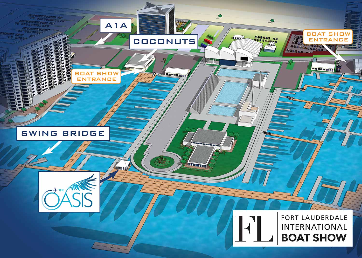
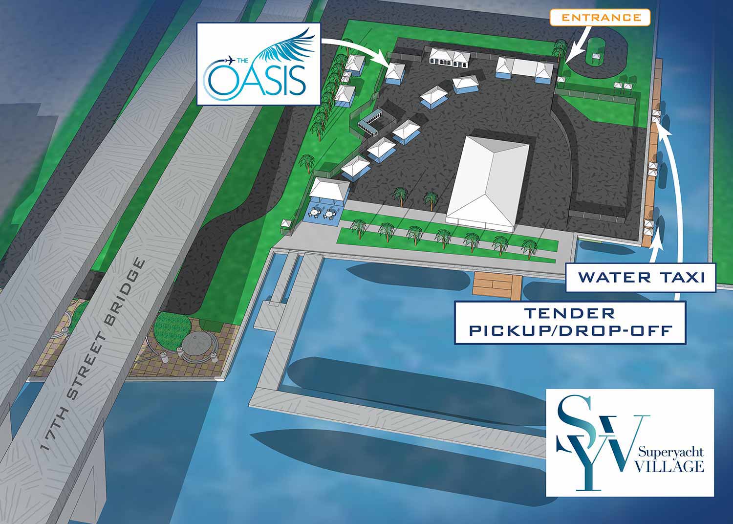
This was my third year working with Global Marine Travel to create maps to promote The Oasis Lounge at the Fort Lauderdale International Boat Show. The Oasis Lounge serves as the Official Hospitality Lounge for Superyacht Captains and Crew, offering gourmet boxed lunches, a fully stocked bar, live music, Wi Fi, and streaming of live sports. For the 2021 show, a lounge was added and now there was a location at the Swimming Hall of Fame and the Superyacht Village at Pier Sixty Six South. I had made one map of each venue for them in past years.
Building on Previous Years
The map you see here is the 2021 update to the work I did. My remained the same. I used a three dimensional digital model of the show grounds that I maintain for all the official FLIBS maps, rendered it from an angle that worked for their specific needs, and added custom branding and labeling.
How The Maps Were Made
As you may know, I create the official maps for the Fort Lauderdale International Boat Show and most other major boat shows in the United States. All of those maps are based on three dimensional digital models of each venue. I keep these models on file and update them annually with new dock layouts, exhibitor locations, and supporting information.
The same methods I use for the official maps can also produce zoomed in views of specific areas or renderings from completely different angles. That means I can create a highly customized map with your own branding, tailored to your specific marketing and wayfinding goals. That is exactly what this map represents. A customized, personalized, branded piece designed for one client's unique needs.
For this project, Global Marine Travel wanted their areas of the boat show shown from a different perspective than the main map uses. I added custom styling, labeled everything for their audience, and included surrounding context that no longer appears on the official show map. The result is a map that serves their guests and no one else's.
What I Can Provide You
If you need a map showing the location of your booth, dock, or exhibit space at any of the shows I work on, contact me. A custom map can give you much more than just a zoomed in version of the main show map, although simple zoomed versions are also available if that is all you need. I can provide a different look and feel, render the venue from angles that highlight your space, and focus on exactly what matters to your clients.
WORK FOR GLOBAL MARINE TRAVEL:


PORTFOLIO GALLERIES
- Illustration work: Start with custom illustration and cover design, then view illustrated maps and architectural renderings.
- Fine art: Discover original paintings and drawings, the Custom Halftone Series, and mural projects.
- Design & motion: Check out the graphic design gallery, then move on to motion graphics and animated illustration.
- Maps by sector: I produce illustrated maps for boat shows, resorts, marinas, real estate, transit & parking, towns & cities, parks, and wayfinding systems.
- More creative services: Additional offerings include cover illustration, vehicle wraps, proposal renderings, and street art.
- Artistic methods: My work spans vector art, isometric & axonometric views, traditional painting, black & white illustration, GeoData mapping, overhead perspectives, and halftone effects. Recently I have also begun to utilize AI in some cases.
- Preferred software: I rely on Photoshop, Illustrator, SketchUp Pro, and InDesign, plus Premiere Pro & After Effects for motion projects.