
Miamarina at Bayside in downtown Miami, Florida Map
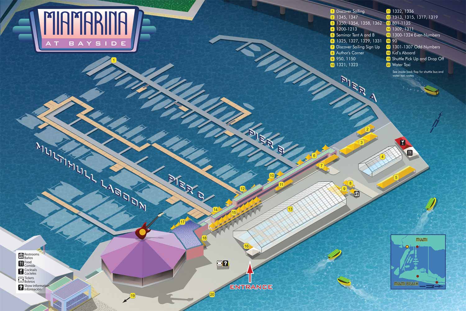
This illustrated map was created for Strictly Sail Miami in 2011, providing a clear overview of the event venue at Miamarina at Bayside in downtown Miami, Florida. The design was developed to serve a dual function: offering precise navigation for attendees while visually capturing the distinctive atmosphere of its vibrant urban waterfront setting.
To present the marina, docks, and surrounding features in an immediately understandable format, I utilized an isometric perspective. This three dimensional view allows the viewer to intuitively grasp the spatial relationships between different areas of the venue. The color palette was chosen to reflect the bright, coastal environment of South Florida. Additionally, subtle Art Deco stylistic elements were integrated into the illustration, a deliberate reference to Miami's iconic architectural heritage and design sensibility. This careful blend of cartographic accuracy and regional style ensures the map operates as both an effective wayfinding tool and an aesthetically engaging graphic.
For practical use, each individual dock is clearly labeled, enabling exhibitors and visiting boaters to locate their assigned positions efficiently. Important destinations and on site amenities are marked with a straightforward numbered system, using prominent yellow dots that correspond to a simple legend for quick reference.
The result is a clean, professional, and approachable map that successfully balances functional clarity with a strong sense of place. It was well suited for integration into the official event program, for use on directional signage, and as a component of promotional materials, effectively supporting both the operations and the ambiance of the show.


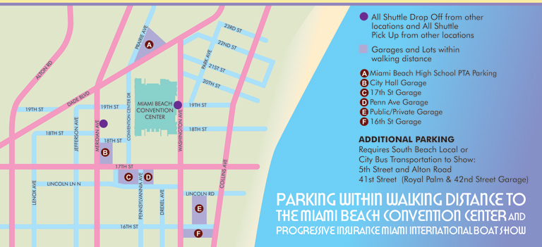


WHAT ARE WAYFINDING MAPS:
Wayfinding maps are maps that help you figure out
- Where you are
- Where you want to be
- and how to get from one to the other
I know what you're thinking... Isn't that all maps? That was my first reaction as well, but this is not necessarily the case. Some maps only provide an overview of an area and some maps show topography or things like crime rates etc. These kinds of maps are becoming more popular with the advent of GIS, but that's another story.
My maps do tend to be geographical in nature and fit the description of wayfinding maps, but I go about it differently on different maps and I place emphasis on different methods. For instance... Some of my maps are overhead street map type maps while most are illustrated. The illustrated maps I create lean more on landmarks as a method of location while overhead maps require the user to think more abstractly and use signs or other markings in the real world to associate the map with reality. Some of my maps specify routes to be taken to reach destinations, some show paths, but leave the user to choose which they take and some simply show where things are in relation to one another giving more directional than specific guidance.
Some people refer to what they call digital wayfinding. This is usually loosely defined as wayfinding on a digital device like a phone or laptop with some form of interactivity involved. The zoomable maps I have on my site fall into this category but beyond that is software that chooses a route for you or describes facilities in your vicinity etc.
If you would like a quote for a wayfinding map please contact me.
EXPLORE MY WORK
- Illustration: Discover custom illustrations, book covers, illustrated maps, and architectural renderings.
- Fine Art: Browse original paintings and drawings, view the Custom Halftone Series, or check out mural projects.
- Graphic Design & Motion: See the graphic design collection, then dive into motion design and animated illustrations.
- Maps by industry: View illustrated maps tailored for boat shows, resorts, marinas, real estate, transportation, towns, parks, and wayfinding.
- More project types: Explore cover art, vehicle wraps, proposal renderings, and street art.
- Techniques & styles: Work spans vector, isometric, painting, black-and-white, GeoData, overhead maps, and halftones.
- Software expertise: Primary tools include Photoshop, Illustrator, SketchUp Pro, and InDesign, plus Premiere Pro & After Effects for motion. I am also supplementing some projects with AI.