
Work for Dinosaur World
One of My Earliest Clients
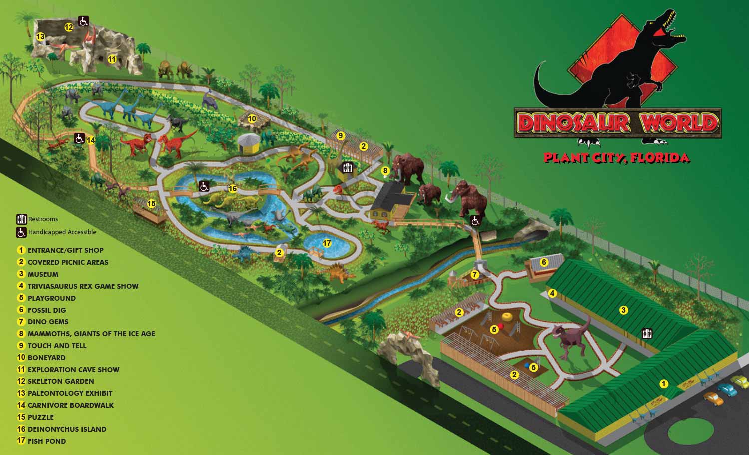
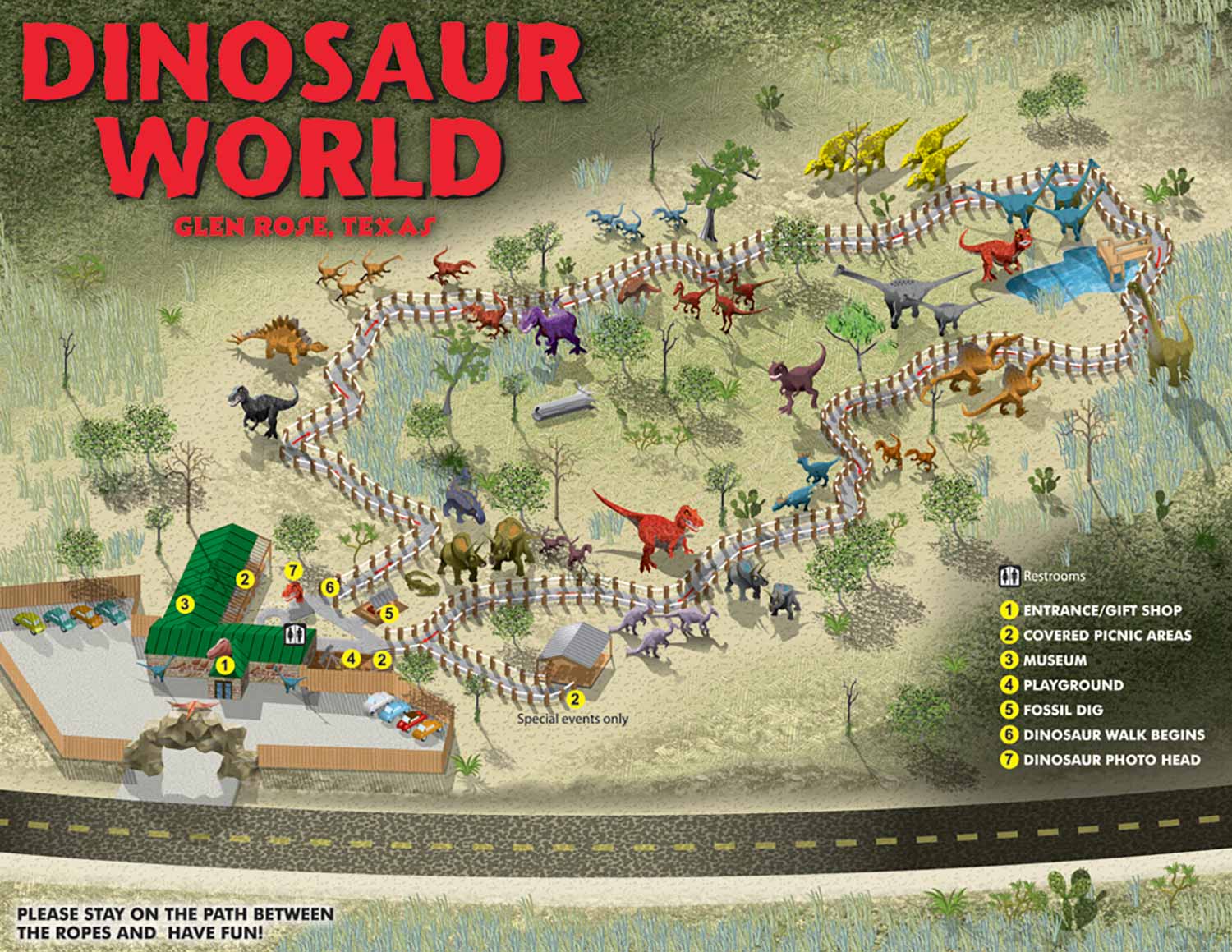
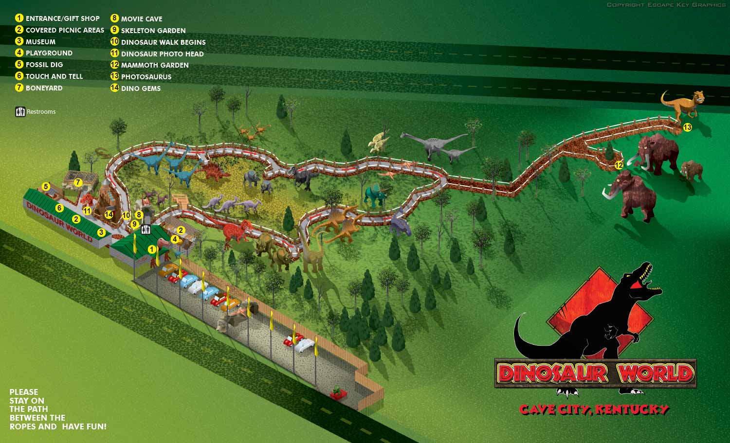
Dinosaur World was one of my first clients. Back then I was making all my maps as isometric or axonometric drawings in Adobe Illustrator. That style, fun and quirky with a cartoon like feel, turned out to be a perfect match for the attraction. It also had the practical benefit of keeping everything at an equal scale across the whole map.
Dinosaur World has parks in Florida, Kentucky and Texas. Each one features loads of life size dinosaur replicas set in a natural environment, along with plenty of other amenities like playgrounds and gift shops.
Starting from Scratch
When they first contracted me, the parks had no maps at all. No CAD drawings. No site plans. Nothing. Faced with a lack of resources, I had to get creative. I used GPS to map out the paths. I also shot lots of photographs, including panoramic photos, which was fairly advanced technology at the time. GPS and panoramic photography were pretty high tech back then.
Using the GPS data, I created KMZ files. Those let me draw the paths and mark the positions of every dinosaur and building. I could then verify everything with the client before I started the actual map. That technique worked so well that I still use it from time to time today.
My Process for Complex Maps
Maps like these can get complicated. The geometry builds up, and my computer starts to bog down. When a layer becomes too complex, I convert the vector file to a flat bitmap. Then I place that bitmap in a new file with the same proportions in Illustrator and keep adding details as vector art on top.
Once the illustration itself is complete, I flatten the whole thing to another bitmap. I place that in yet another new file with the same proportions and add all the keying, labeling, and final graphics. That final file goes to the client. They can make minor revisions in house, like updating a label or changing a phone number. If they need to change the actual illustration, that requires my help. I also provide web friendly versions in JPG and PDF formats.
How the Maps Are Used
Dinosaur World uses these maps across all their parks. They hand them out to guests as printed guides. They put them up as signage around the properties. They feature them on their websites leveraging the assets for wayfinding as well as marketing. Over the years I have made revisions as the parks have grown and expanded. New dinosaurs get added. New paths get built. The maps keep up.
Your Project
If you are interested in illustrated maps or visual materials like the work I have done for Dinosaur World, contact me. I have done this work before and I would be glad to do it for you.


EXPLORE MY WORK
- Illustration: Discover custom illustrations, book covers, illustrated maps, and architectural renderings.
- Fine Art: Browse original paintings and drawings, view the Custom Halftone Series, or check out mural projects.
- Graphic Design & Motion: See the graphic design collection, then dive into motion design and animated illustrations.
- Maps by industry: View illustrated maps tailored for boat shows, resorts, marinas, real estate, transportation, towns, parks, and wayfinding.
- More project types: Explore cover art, vehicle wraps, proposal renderings, and street art.
- Techniques & styles: Work spans vector, isometric, painting, black-and-white, GeoData, overhead maps, and halftones.
- Software expertise: Primary tools include Photoshop, Illustrator, SketchUp Pro, and InDesign, plus Premiere Pro & After Effects for motion. I am also supplementing some projects with AI.