
An illustrated map of a cabin & RV park in Denison, TX
I created this map.
For more (and the latest) information about Grandpappy Point Resort & Marina please visit their site GrandPappy.com.
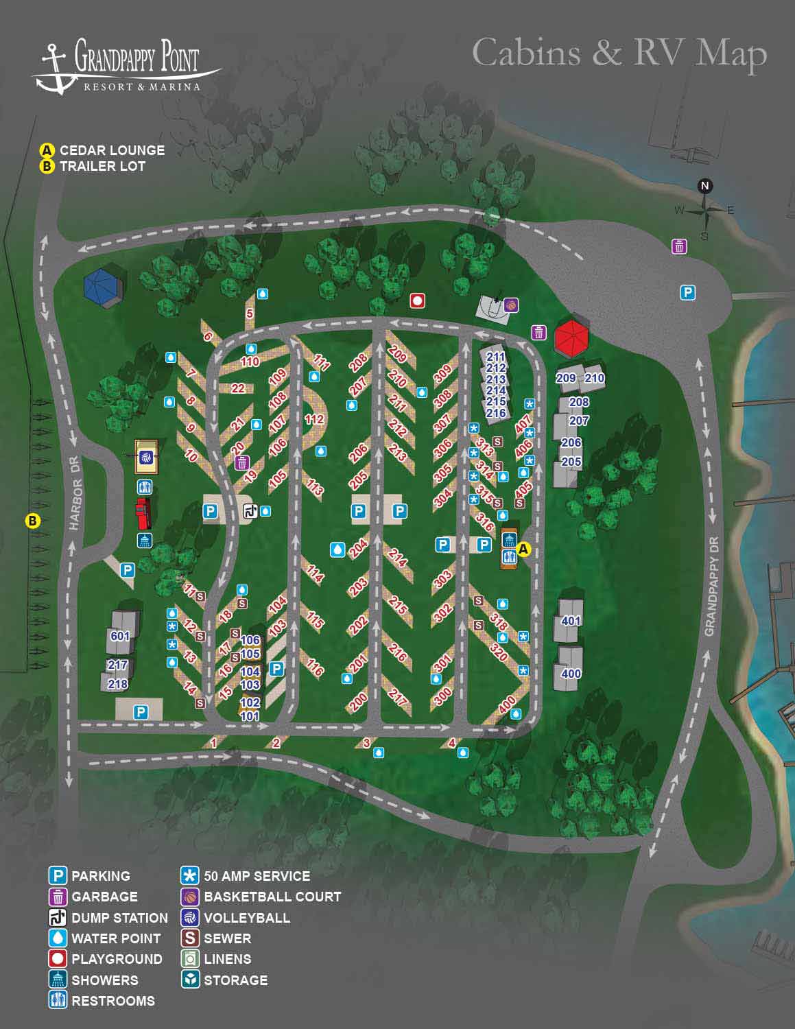
I created a custom illustrated map for Grandpappy Point Resort and Marina’s Cabin and RV Park on Lake Texoma in Denison, Texas. Known for its scenic waterfront locations and wide range of outdoor amenities, Grandpappy Point offers cabins, RV spaces, and boating facilities for visitors seeking a memorable vacation experience. The purpose of this map was to provide a clear and accurate overhead view of the park that supports both everyday operations and visitor navigation.
The map features cabin and RV site locations along with key park elements such as roads, common areas, restrooms, and access points. Because it was designed for management as well as guests, the layout is straightforward and highly legible. This makes it easier for staff to communicate site locations and park features while helping guests orient themselves quickly when they arrive. The visual style is clean and engaging, giving the park a polished look that works well in printed guides, digital directories, and marketing materials.
A well-designed illustrated map like this can benefit cabin and RV parks in multiple ways. It improves wayfinding for visitors, supports internal logistical planning, and enhances the overall guest experience by setting clear expectations before arrival. For parks looking to improve their visual communications or strengthen their brand presentation, custom map illustration is a valuable tool that combines accuracy with aesthetic appeal. Visit my portfolio to see more examples of maps created for parks, marinas, and resort properties.
If you have a need for a similar map contact me.
WORK FOR GRANDPAPPY POINT RESORT & MARINA:


BROWSE MY WORK
- Illustration: Browse custom illustrations, book cover art, illustrated maps, and architectural renderings.
- Fine art: View original paintings and drawings, the Custom Halftone Series, and mural commissions.
- Graphic design & motion: See design projects, then watch motion reels and animated pieces.
- Maps by use case: Explore illustrated maps created for boat shows, resorts, marinas, real estate, transportation & parking, cities & towns, parks, and wayfinding.
- Specialty projects: Also check out cover design, vinyl & vehicle wraps, proposal renderings, and street art.
- Style & technique: Discover vector, isometric, painterly, monochrome, data-driven, bird's-eye, and halftone approaches.
- Tools I use: Everyday software includes Photoshop, Illustrator, SketchUp, and InDesign; motion work relies on Premiere & After Effects. Recently I have begun some work using AI as well.