
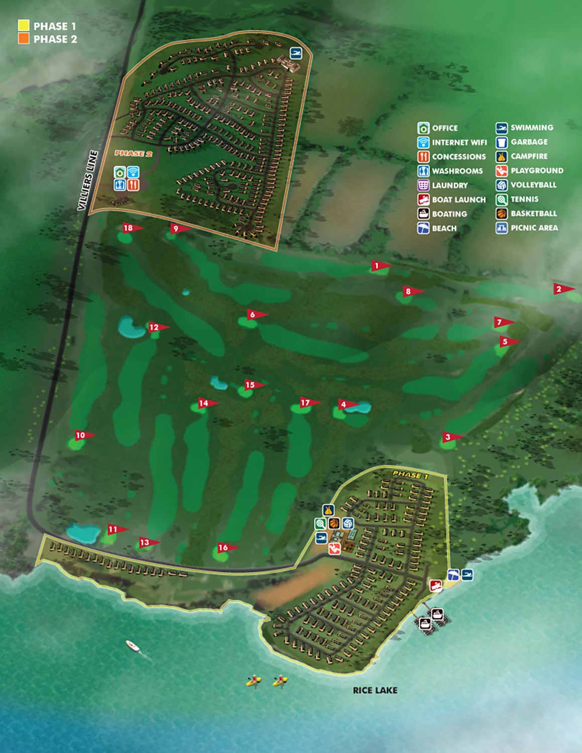
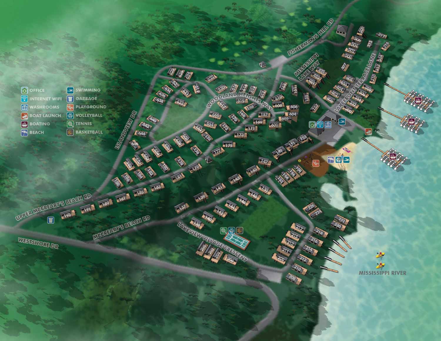
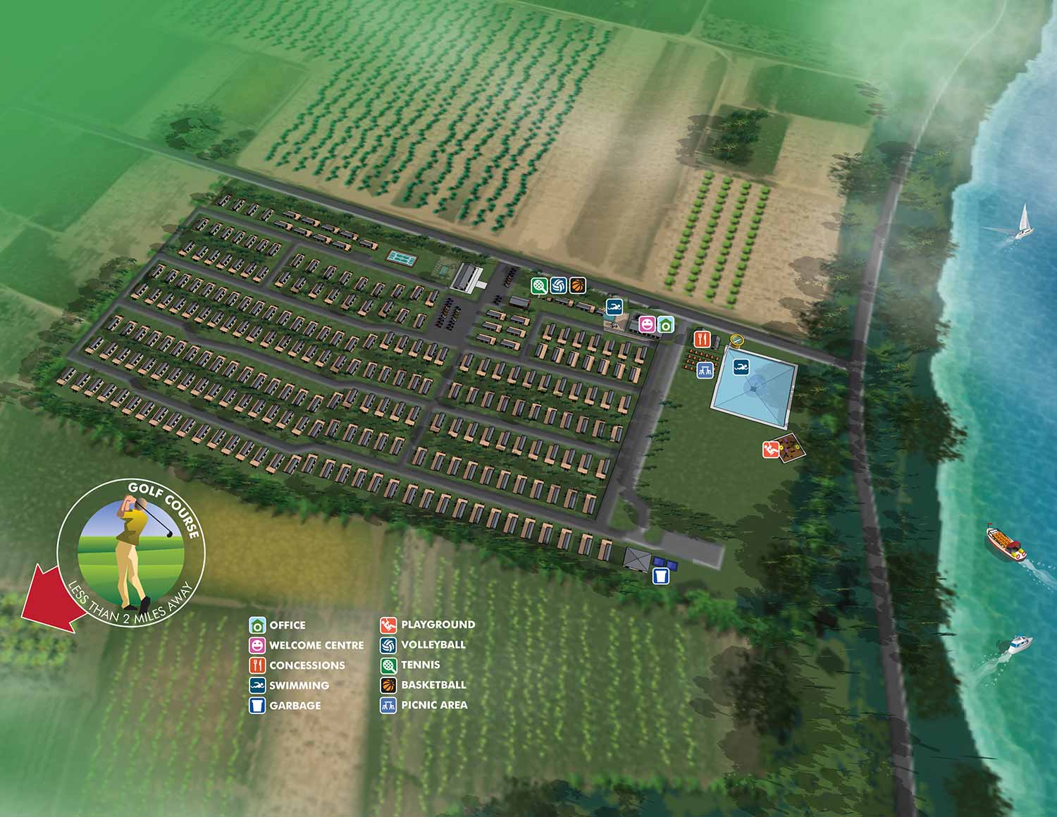
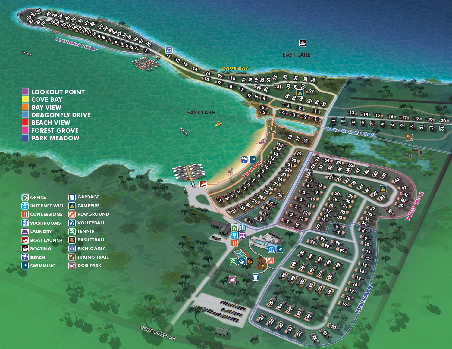
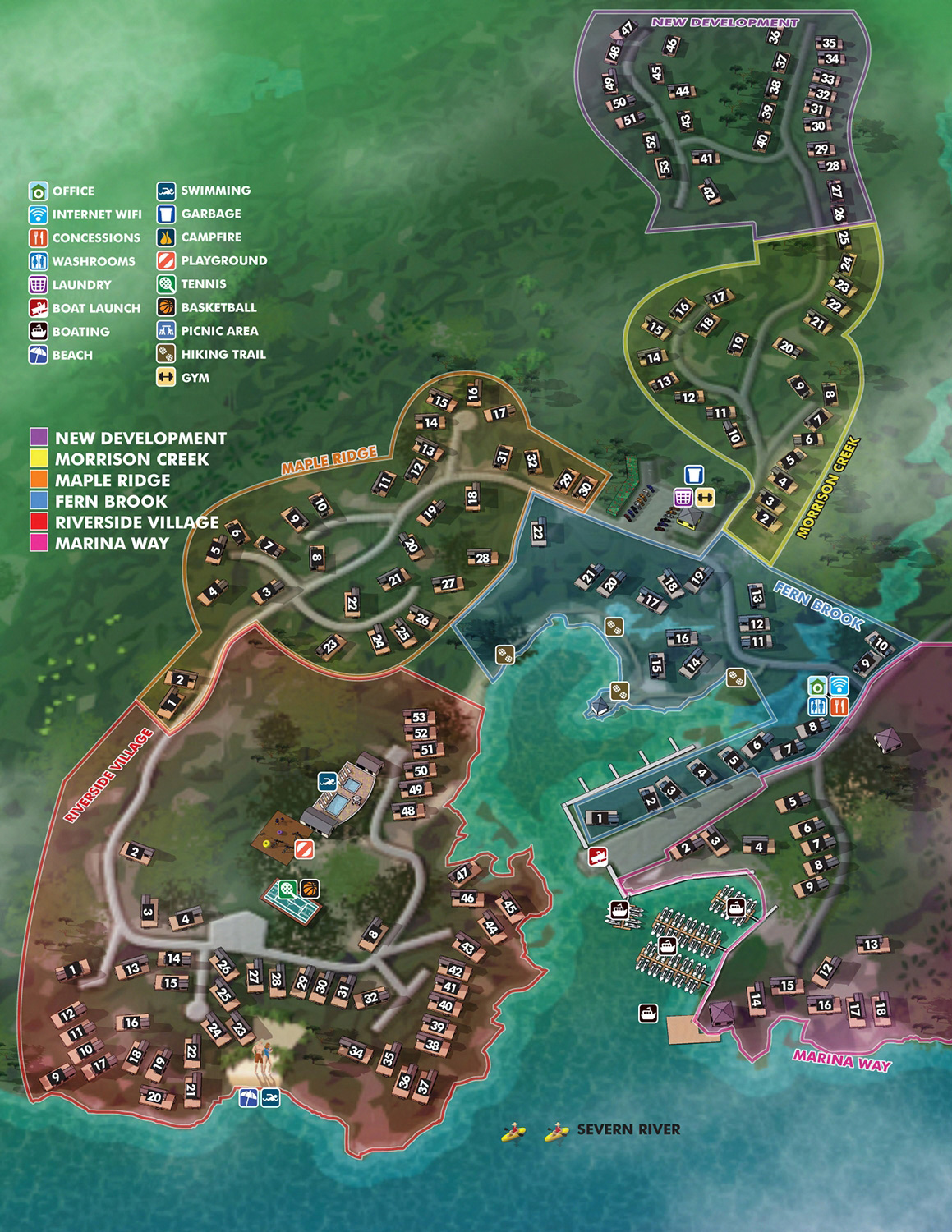
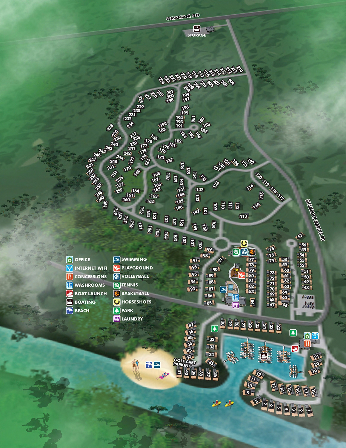
Illustrated map of a resort showing cabin and cottage locations as well as services and other accommodations for use by guests and staff
Client: Great Blue Resorts
I am the artist who made these maps. They are many years old. For the latest and most accurate information on any of these resorts please visit GreatBlueResorts.com
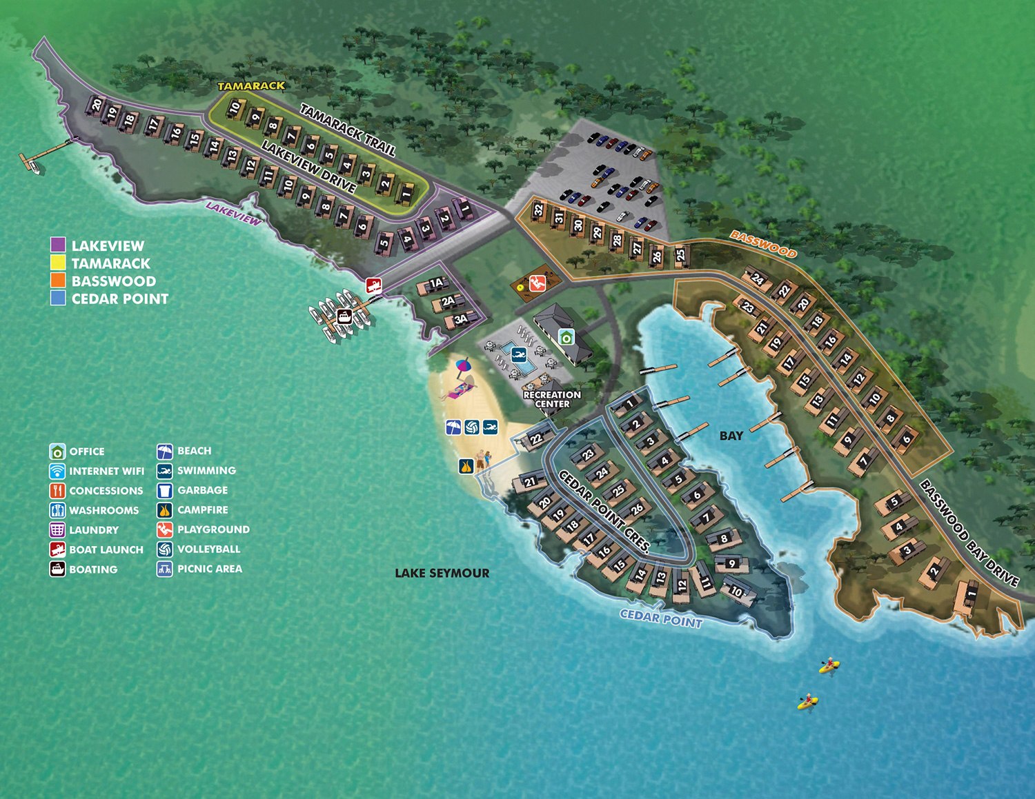
Great Blue Resorts was one of my primary clients for a number of years. I created illustrated maps for many of the properties they owned or represented across Ontario. The map shown here is for Woodland Estate Resort in Campbellford, Ontario.
Woodland Estate Resort offers a serene environment away from the hustle and bustle. The resort makes a great getaway resort on the lake featuring stunning lakefront views and breathtaking sunrises. The resort is only 10 minutes from Campbellford, here you can take a stroll along the downtown streets lined with quaint shops, restaurants, and inviting boutiques. During the summer months enjoy the vibrancy of the Warkworth, Westben, and Crooks Rapids music festivals nearby.
My approach for these projects was always similar. I provided a clear overview of the property and use graphical icons to mark facilities guests actually need. Lodging, dining, recreation, parking. Everything in one place, easy to find at a glance.
This particular map features cottage numbers and road names labeled directly on the illustration. Guests can find their specific rental without asking at the office. Staff can direct people with precision. It is a small detail that makes a real difference in how a property runs.
This map also features color coded subcategorized areas for more granular navigation of the site through a layered system.
If you manage a resort, a golf course, or a mixed use property and need a clear, useful illustrated map, contact me. I have done this work before and I can do it for you.


PORTFOLIO GALLERIES
- Illustration work: Start with custom illustration and cover design, then view illustrated maps and architectural renderings.
- Fine art: Discover original paintings and drawings, the Custom Halftone Series, and mural projects.
- Design & motion: Check out the graphic design gallery, then move on to motion graphics and animated illustration.
- Maps by sector: I produce illustrated maps for boat shows, resorts, marinas, real estate, transit & parking, towns & cities, parks, and wayfinding systems.
- More creative services: Additional offerings include cover illustration, vehicle wraps, proposal renderings, and street art.
- Artistic methods: My work spans vector art, isometric & axonometric views, traditional painting, black & white illustration, GeoData mapping, overhead perspectives, and halftone effects. Recently I have also begun to utilize AI in some cases.
- Preferred software: I rely on Photoshop, Illustrator, SketchUp Pro, and InDesign, plus Premiere Pro & After Effects for motion projects.