
East Beach Park - SOUTHFIELD - Residential Park Map
For information on East Beach Park Residential Park please visit Tingdene-Parks.net
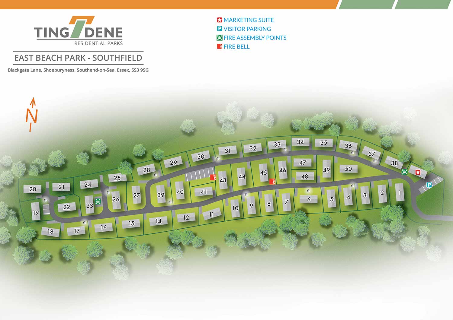
East Beach Residential Park is an exclusive development set in a peaceful seaside location, offering coastal living within convenient reach of London. The area is rich in history, with origins dating back to the Stone Age and archaeological finds on display at the Prittlewell Priory Museum. The surrounding area offers a wide range of attractions, including a planetarium, Adventure Island, Hadleigh Castle and Country Park, Belfairs Park and Nature Reserve, and the Southend Museum and Discovery Centre. Southend on Sea is also home to the longest pleasure pier in the world, providing entertainment, shops, and traditional seaside amusements.
Escape Key Graphics created this illustrated overhead real estate map to clearly communicate the layout of the park and support easy navigation for residents, visitors, and prospective buyers. Individual plots are clearly numbered, allowing key information to be understood quickly without overcrowding the illustration. This ensures the map remains clear, accessible, and practical for everyday use.
Simple and consistent graphic icons are used to identify park amenities such as parking areas and the marketing suite. Designed to support both practical and promotional needs, the map functions effectively as on site signage and general wayfinding, while also serving as a refined marketing asset. The map presents the layout and features of East Beach Residential Park in a professional and approachable manner, helping convey the character, setting, and overall appeal of the park to those considering it as a place to live.


WORK FOR TINGDENE - COMBINED MARINA AND RESIDENTIAL PARK MAPS:


BROWSE MY WORK
- Illustration: Browse custom illustrations, book cover art, illustrated maps, and architectural renderings.
- Fine art: View original paintings and drawings, the Custom Halftone Series, and mural commissions.
- Graphic design & motion: See design projects, then watch motion reels and animated pieces.
- Maps by use case: Explore illustrated maps created for boat shows, resorts, marinas, real estate, transportation & parking, cities & towns, parks, and wayfinding.
- Specialty projects: Also check out cover design, vinyl & vehicle wraps, proposal renderings, and street art.
- Style & technique: Discover vector, isometric, painterly, monochrome, data-driven, bird's-eye, and halftone approaches.
- Tools I use: Everyday software includes Photoshop, Illustrator, SketchUp, and InDesign; motion work relies on Premiere & After Effects. Recently I have begun some work using AI as well.