
Castle Hill Residential Park Map
For information on Castle Hill Residential Park please visit Tingdene-Parks.net
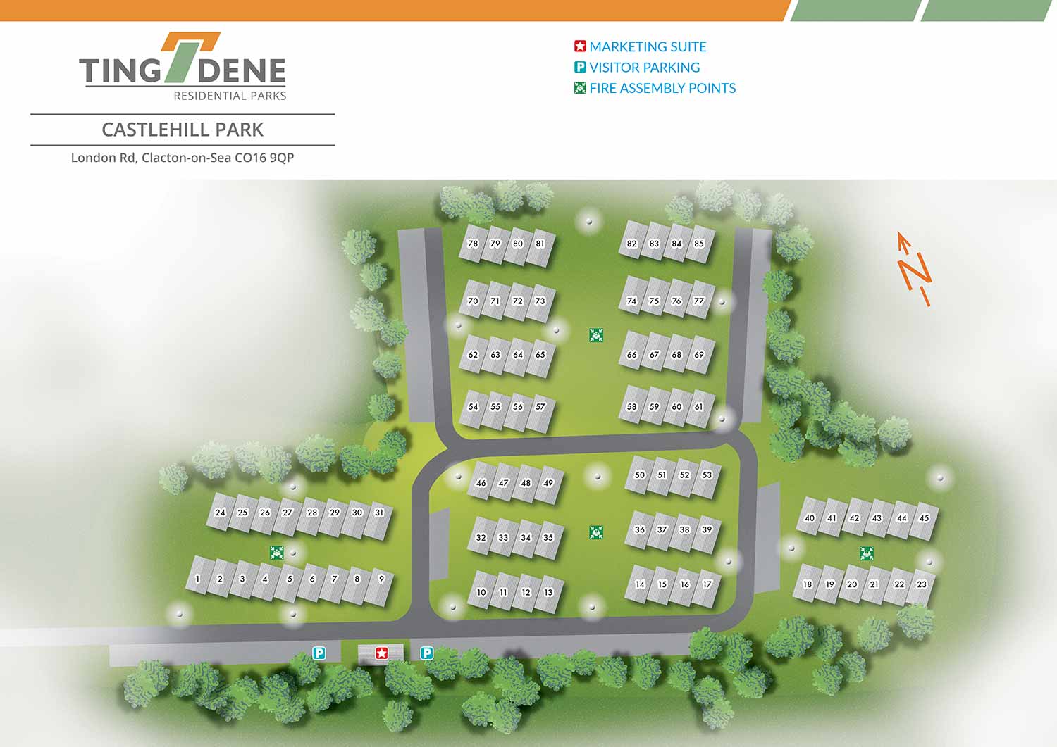
Castle Hill Residential Park is located in a peaceful yet well connected setting near Woodley, offering attractive views across the surrounding countryside. As an established and well maintained park home estate, it provides a calm residential environment while remaining close to local amenities and transport links. The combination of rural outlook and everyday convenience makes Castle Hill an appealing option for those seeking comfortable residential living.
Escape Key Graphics created this illustrated overhead real estate map using a vector based illustration approach that makes considered use of negative space. This creates a light, open visual quality while keeping the focus firmly on the layout of the park and its individual properties. Although the illustration has a distinct visual character, the overall treatment is intentionally restrained to ensure the map remains clear and easy to navigate. Residential plots are labelled directly within the artwork, allowing residents, visitors, and prospective buyers to orient themselves quickly and confidently.
Park amenities and essential services, including fire assembly points, are clearly identified using simple and easily recognisable graphic icons. The map has been designed to support a wide range of practical and promotional uses. It functions effectively as on site signage and general wayfinding, helping people move comfortably through the park, while also serving as a polished marketing asset that presents the layout and features of Castle Hill Residential Park in a professional and approachable manner.


WORK FOR TINGDENE - COMBINED MARINA AND RESIDENTIAL PARK MAPS:


PORTFOLIO SELECTIONS
- Custom illustration & covers: Featuring bespoke illustration, book and magazine covers, hand-drawn maps, and building renderings.
- Fine art & murals: Including one-of-a-kind paintings and drawings, the Custom Halftone Series, and large-scale murals.
- Design & motion media: Covering graphic design, plus video and motion and animated illustration.
- Mapping by application: Tailored maps for marine events, hospitality, waterfront, property, transit, municipal, recreation, and navigation needs.
- Additional creative work: Includes editorial covers, vehicle graphics, concept renderings, and public art.
- Mediums & formats: Ranging from digital vector and isometric projection to traditional paint, line art, GIS-based, aerial-style, and halftone.
- Software expertise: Proficient in Photoshop, Illustrator, SketchUp, InDesign, and Premiere/After Effects for motion. More recently I have worked with AI.