
Parking and Transit Map for the Miami International Boat Show - 2023 - Version in the Show Program
For information about the Miami International Boat Show and to ensure you're seeing the latest maps and information visit MiamiBoatShow.com
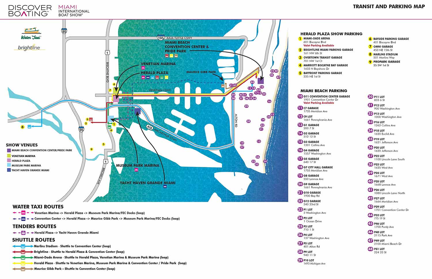
The 2023 Miami International Boat Show Transit and Parking map was updated from the previous year to include additional information while maintaining a clear and intuitive design. This type of map is an essential tool for an event with dedicated transportation systems.
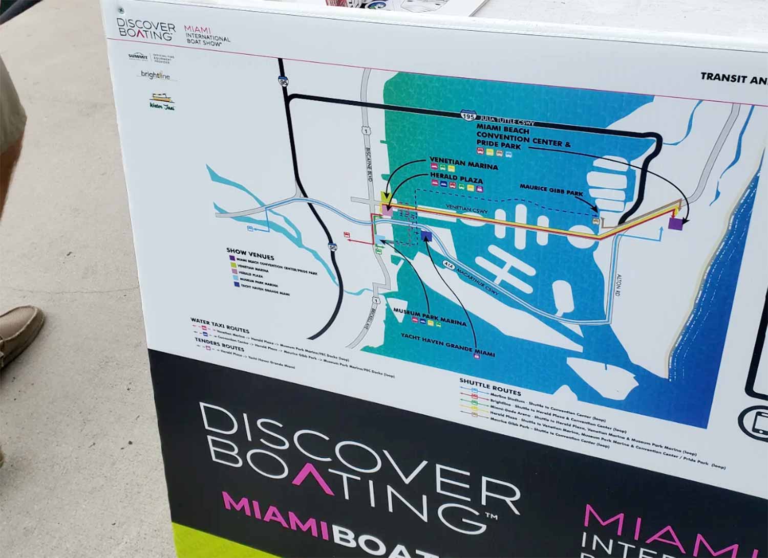
Designed as an overhead, street-style illustration, the map provides a straightforward overview of shuttle routes and stops, water taxi routes and boarding locations, and general parking areas. Parking locations are highlighted visually, with addresses included for GPS navigation. Show venues, shuttle routes, and water taxi routes are colour coded and reinforced with easy-to-read icons, while major roadways are clearly marked to assist drivers.
Despite its simplicity, the map consolidates a large amount of logistical information into a clean and readable format. It serves as a practical planning tool, helping visitors navigate confidently and spend more time enjoying the show. Three dedicated versions were produced for the official program, on-site signage, and online use, ensuring consistency and accessibility across all platforms.
Miami International Boat Show Maps 2023:
Venetian Marina and One Herald Plaza | Museum Park | Miami Beach Convention Center Map | Transit and Parking | Pride Park | Program LayoutMaps For Boat Shows In Miami:
- About Miami Boat Shows
- Miami International Boat Show / Miami Yacht Show / Yachts Miami Beach / Miami Beach Yacht and Brokerage Show - Show Center/Primary Venue Maps: 2026 | 2025 | 2024 | 2023 | 2022 | 2020 | 2019 | 2018 | 2017 | 2016 | 2015 | 2014 | 2013 | 2012 | 2011
- Transportation Map: 2026 | 2025 | 2024 | 2023 | 2022 | 2020 | 2019 | 2016 | 2013 | 2012
- Program Layout: 2026 | 2025 | 2024 | 2023 | 2022
- Yacht Haven Grande at Island Gardens: 2026 | 2022 | 2020 | 2016
- Miami Beach Convention Center: 2026 | 2025 | 2024 | 2023 | 2022 | 2013 | 2012
- Sea Isle Marina Only: 2013 | 2012
- Miamarina at Bayside Only: 2013 | 2012 | 2011
- Bayfront Park: 2015
- Museum Park Marina: 2025 | 2024 | 2023 | 2022
- Illustration (not a map): 2014
- Video: 2013
EXAMPLES OF MAPS CREATED FOR MIAMI BOAT SHOWS:


EXPLORE MY PORTFOLIOS
- Illustration: Find custom illustration, book covers, illustrated maps, and architectural rendering.
- Fine Art: Browse original paintings and drawings, the Custom Halftone Series, and murals.
- Graphic Design & Motion: See my graphic design work, plus motion design and animated illustrations.
- Maps by industry: Illustrated maps tailored for boat shows, resorts, marinas, real estate, transit & parking, towns & cities, parks, and wayfinding.
- Other project types: Also available: cover art, vehicle & vinyl wraps, proposal renderings, and street art.
- Techniques: Explore work in vector, isometric & axonometric, painting, black & white, GeoData, overhead, and halftone styles. Recently I have also begun to use AI for some specific solutions.
- Software: Primary tools: Photoshop, Illustrator, SketchUp Pro, and InDesign. Motion work uses Premiere Pro & After Effects.