
Fort Lauderdale International Boat Show 2023 - Parking and Transportation Map
Client: Informa Markets
For more (and more up to date) information about the 2023 Fort Lauderdale International Boat Show visit their official site at FLIBS.com.
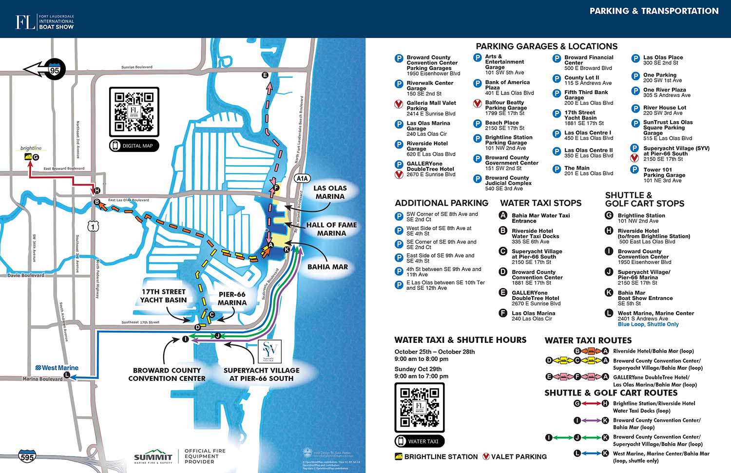
The 2023 Fort Lauderdale International Boat Show transportation map was primarily an update to the previous year's successful design. Because the 2022 map had established such a solid and effective foundation, the focus for this edition was on implementing necessary annual changes, such as updates to parking lot listings and minor adjustments to transit routes, while preserving the core structure that worked well.
The most significant design improvement for 2023 was the removal of individual parking location markers from the illustration itself. This decision greatly reduced visual clutter on the map. The essential information was not lost; a complete list of parking facilities with their addresses was still provided alongside the map. This approach allows attendees to use the addresses with their GPS for precise navigation, which has proven to be a more practical and user friendly solution. This method has been maintained in subsequent years. Additionally, a redundant color key of small square icons used to identify venues was eliminated, as the venues were already clearly labeled on the map directly. These refinements resulted in a notably cleaner and more focused final product.
The established keying systems were retained with only minor changes to ensure continuity for returning visitors. Parking was listed with addresses, while water taxi, shuttle and golf cart stops were indicated with white letters on black dots. Transit routes continued to use a separate, clear color key, and the Brightline station and West Marine were marked with their logos displayed very small. The map and its accompanying key were designed to integrate seamlessly as a double page spread in the official show program, a publication for which I have handled the page layout since 2022.
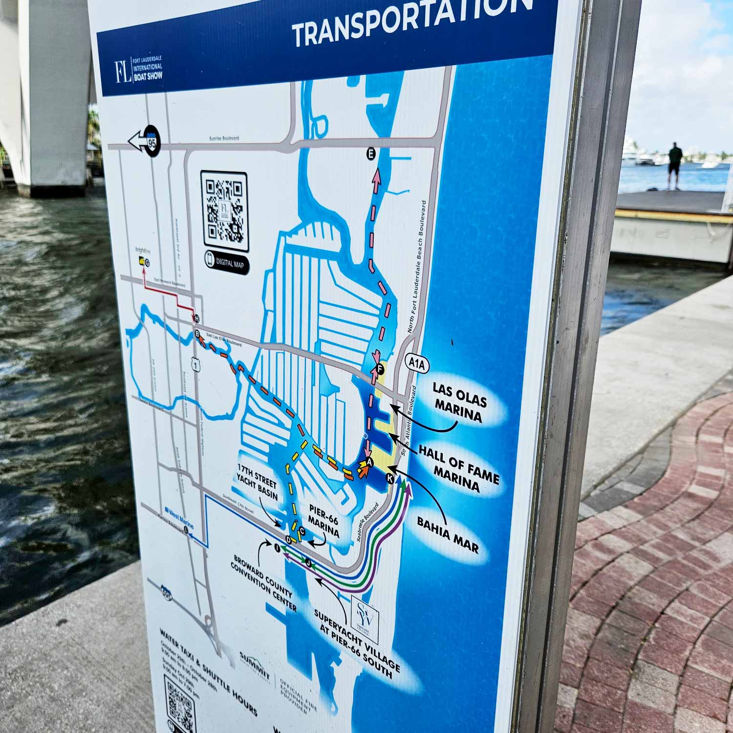
This map was utilized across multiple platforms: online for pre event planning, on onsite signage, and in the printed show program. It is important to recognize that a well designed map like this serves as a powerful marketing tool. Unlike generic lifestyle photography, it provides concrete, actionable content that allows potential attendees to visualize their visit, plan their transportation, and engage with the event layout long before they arrive, building both confidence and anticipation.
To view this and other examples of functional event graphics, please visit my maps portfolio.
Fort Lauderdale International Boat Show Maps 2023:
Bahia Mar, Swimming Hall of Fame & Las Olas Marina | Transit and Parking | Marinas (17th St Cswy) | Broward County Convention Center Map | Program Layout


MAPS FOR BOAT SHOWS IN FORT LAUDERDALE:


Fort Lauderdale International Boat Show Maps:
- About Fort Lauderdale International Boat Show
- Bahia Mar, Swimming Hall of Fame & Las Olas Marina Maps: 2025 | 2024 | 2023 | 2022 | 2020 | 2019 | 2018 | 2017 | 2016 | 2015 | 2014 | 2013 | 2012 | 2011 | 2010
- Parking and Transportation Maps: 2026 | 2025 | 2024 | 2023 | 2022 | 2020 | 2019 | 2018 | 2015 Bus | 2015 Water Taxi | 2014 | 2013 | 2012 | 2011
- Broward County Convention Center Maps: 2026 | 2025 | 2024 | 2023 | 2022 | 2017 Sailfish Pavilion | 2017 | 2016 Sailfish Pavilion | 2016 | 2015 Sailfish Pavilion | 2015 | 2014 Sailfish Pavilion | 2014 | 2013 Sailfish Pavilion | 2013 | 2012 | 2011 | 2010
- 17th St Marinas Maps: 2026 | 2025 | 2024 | 2023 | 2022 | 2019 | 2016
- Show Directory Layouts: 2025 | 2024 | 2023 | 2022
- Video: 2013 54th Annual
- Illustrations (not maps): 2014A | 2014B


PORTFOLIO GALLERIES
- Illustration work: Start with custom illustration and cover design, then view illustrated maps and architectural renderings.
- Fine art: Discover original paintings and drawings, the Custom Halftone Series, and mural projects.
- Design & motion: Check out the graphic design gallery, then move on to motion graphics and animated illustration.
- Maps by sector: I produce illustrated maps for boat shows, resorts, marinas, real estate, transit & parking, towns & cities, parks, and wayfinding systems.
- More creative services: Additional offerings include cover illustration, vehicle wraps, proposal renderings, and street art.
- Artistic methods: My work spans vector art, isometric & axonometric views, traditional painting, black & white illustration, GeoData mapping, overhead perspectives, and halftone effects. Recently I have also begun to utilize AI in some cases.
- Preferred software: I rely on Photoshop, Illustrator, SketchUp Pro, and InDesign, plus Premiere Pro & After Effects for motion projects.